Wednesday, October 26, 2022

September 29, 2022 - Prairie Mountain, The Elbow, Kananaskis

Mandy and I headed out to Prairie Mountain for a quick hike.  As mentioned previously this is not our favourite hike.  Upside: close to our house (15 minutes door to trail head), decent workout, nice views at the top.  Downsides: over-popular, steep, washed-out trail.  We consider it a "utility hike" - it's a good quick hike when time is short, and a bit of a work-out is needed.  As with our luck this hiking season, the day we picked was not ideal - smokey, and overcast, with some showers on the way down.

Despite all of the above negativity we did get a good workout, we saw only one other person on the way up and three grouse on the way down, and we did spend a couple of hours outside in nature.  I still feel very lucky to be so close to all of the beautiful places in Kananaskis and to be able to access all variety of trails whether I love them or not.  All-in-all I would say a 1.5 thumbs up outing!  😉

Summit Selfie

Summit Descent - Looking Towards Iyarhe Ipan

Smokey Peekaboo View

Elbow River And Fall Colours Just Before The Trailhead

September 24-25, 2022 - Overnight Kayak - Island Lake, Deer Lake, Crooked Lake, Beaver/Swallwell Lake, BC

I was visiting some friends in Vernon in the spring when Sam had a hockey camp in Salmon Arm.  My buddy Ryan mentioned one night that he had been wanting to take his kayak out to some lakes in the back country near his place, and do an overnighter.  I thought it sounded like an amazing idea so I invited myself... 😆  After a bit of co-ordination (both of us are on different rotations in a commuting job) we managed to pull the trigger in late September, before it would start to get to cold.

After driving up on Friday, we packed up the gear Saturday morning and hit the backroads to Island Lake Recreation Site.  After a quick recce and some discussion we decided to set up camp there as opposed to lugging all of our gear by kayak to a nearby island as originally planned.  It seemed much more convenient to take a site with a fire pit and picnic table, and would give us a couple more hours of kayak time to enjoy.  Once the campsite was set up we hit the water around 1:30 and started paddling.

Initial Recce

Heading Towards The Channel From Island Lake To Deer Lake

Island Lake is the second lake of a five lake chain.  We headed south through Deer Lake, Crooked Lake, and after a short portage into Beaver/Swallwell Lake.  It was a very beautiful and peaceful experience, that I truly enjoyed.  Being on the water, at the slow pace of a paddle-operated kayak, allows you to take in the sights and sounds that a motorboat may speed by and drown out.  After a little break on an island beach at the last lake we got back into our kayaks for the paddle back.  The headwind didn't deter us, as we had a delicious hot dog dinner planned to motivate us to keep paddling. 😂

Beaver/Swallwell Lake

Crooked Lake - Just After The Portage Back

After dinner we sat by the fire ands solved a few of the worlds problems (and drank a few beer) before turning in.  It was a chilly night but about four blankets each helped us keep warm.  After a decent nights rest we got up, packed up, and headed back to civilization.  I was really glad we were able to make this little adventure happen, and it has sparked a few more ideas for some new ones in the future!

The Island On Island Lake - Sunrise Shot

Monday, September 12, 2022

September 11-12, 2022 - Wild Camp - Bryant Lake, Powderface Trail, Kananaskis

Mandy and I have been talking about heading out to Bryant Lake for an overnighter for the past few weeks, and finally pulled the trigger on it last night.  The weather was looking good, and the timing was right.  Of course with Mother Nature things can always change in an instant...
We made it to the trail head a little later than we had hoped due to a couple of last-minute phone calls that came in just before we left.  We had also noted an hour or two before we left, that a lot of smoke had blown into the valley from forest fires in the province.  We decided to make a go of it anyway, and were walking by 17:50.

Trail Head Selfie

Very Smokey In The Valley

The Bryant Lake trail is a very fun hike (depending how you see it), up a dry creek bed to a hidden lake cradled in a basin underneath Mount Bryant.  There is a lot of rock-hopping and dry creek crossing in between intermittent braided trails.  If you are tired, or have ankle issues, this may be a little challenging, otherwise I think it is very fun.

Narrow Section Of Creek Bed

We Saw Many Patches Of This Bright Red Plant All The Way Up The Creek Bed

After about 5.5 km of creek bed, followed by a steeper 0.5 km forest section the scenery opens up to beautiful meadows surrounded by stunning ridgelines.  Things got a little interesting here.  What started out as a nice breeze at the trail head turned into the windiest conditions Mandy or I had ever hiked in.  One gust lifted me off one foot and almost blew me over.  I had to take a very wide stance and lean into the wind in order to stay on my feet.  It was a little unsettling, but we knew we would be able to find shelter from the wind in some trees near the lake.

Meadow Section After The River Bed

Final Approach To The Lake

There was not much light left when we got to our destination so we quickly set up camp and headed over by the lake for some much-anticipated dinner.  I had brought two mini-bottles of Baileys for our coffee/teas, but when we went to open them we found that they had solidified after years of sitting in our cupboard... 😂

Rice And Meatball Dinner (And Solidified Baileys)

After dinner we loaded up the bear vault with all food items and smelly stuff and stashed it a couple of hundred meters away from our tent.  Once in the tent we got our PJs on and started to hunker down.  Sleeping in a tent in the Canadian wilds sometimes takes getting used to.  It is easy to work yourself up to the point where falling asleep is challenging.  Some thoughts that were going through my mind: will this wind blow a tree down on us, are there bears or cougars in the area, and will I even hear them with all of this wind.  Then once the wind died down: I wish it was windy again so I won't hear anything else that might be around! 😝  As always, after an hour or two of trying to settle, fatigue wins over and intermittent sleep comes.  I think we both had one good stint between 12:30 and 4:30, and maybe an hour or two more after a bathroom break around 5:30.  At 7:30 with a mixture of relief and resistance we started getting up and prepared for the trek back home.

Pre-Wakeup Selfie 😄

Morning Campsite

Coffee And Tea By The Lake Before The Walk Out (Bear Vault On Right)

A couple of hours later we were back at the car and heading home to let the cats out.  Despite the smoke, wind, and fitful sleep, I am always excited about the experiences we have in the back-country, and we never regret having made the effort!


UPDATE - We saw these cows on the way back.  With the thousands of acres of available land in Kananaskis, for some reason this seemed like the best spot to lay down and have a rest....

😁😝😆😄😛

Thursday, September 1, 2022

August 24, 2022 - Ice Line Trail, Yoho Valley, Yoho National Park

A friend of mine and I attempted this loop last October, and were forced to turn around due to snow.  At the time we agreed that we would make another attempt this summer when snow would not be an issue.  After a few logistical schedule changes we finally got out last week, and I was most definitely not disappointed.
We met at the Petro-Canada on Hwy. 1 at 7:00 a.m. and left together from there.  The weather was partially cloudy and cool (~10 C), which would make for a great day of hiking.  Just over two hours later we were on the trail which starts in Yoho Valley, near Takakkaw Falls at the Whiskey Jack Hostel.  We started up the well defined and maintained trail, which has you cover ~575 m of the total 900 m in the first 3.5 km...  The views start to come quickly, and once you are above the tree line there are non-stop 360-degree vistas to enjoy.

Looking Back Towards The Trail Head And Takakkaw Falls

Above The Tree Line

Below Emerald Glacier - Sweat Stains Reveal How Hard I was Working 😝

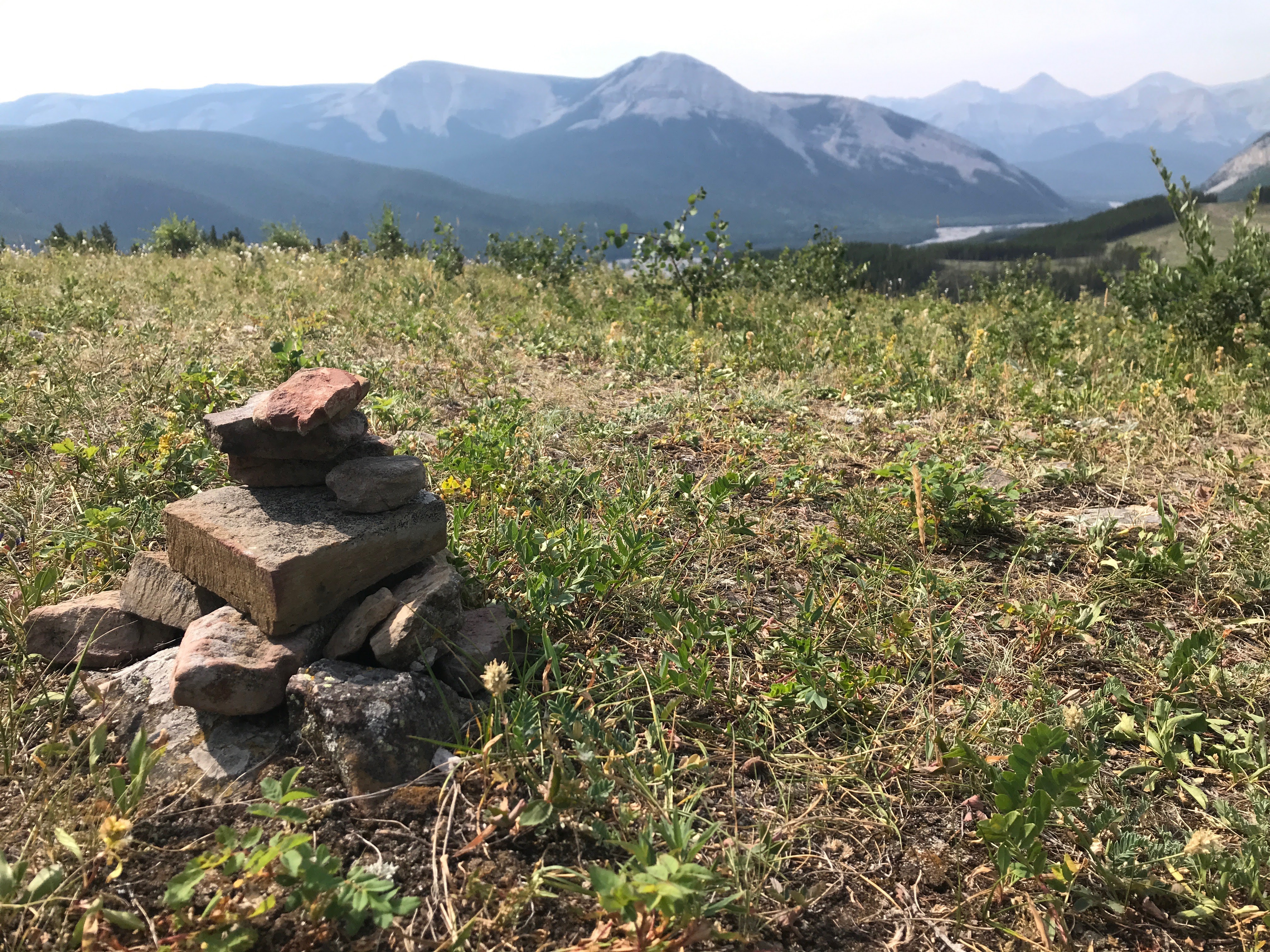
My buddy has done a lot of ski touring in this area over the years and as a result was an excellent tour guide for the hike pointing out alpine huts (Stanley Mitchell Hut, Scott Duncan Hut, Twin Falls Chalet), naming all of the surrounding mountains (President, Vice President, Secretary-Treasurer, McArthur, Isolated, Wapta, Cathedral, Balfour, Whaleback), and identifying several glaciers and icefields (Emerald Glacier, Fairy Glacier,  Waputik Icefield)

Beautiful Mountain Meadow

North Towards Troltinder Mountain and Mount Balfour (3,272 m)

Emerald Glacier With The President And the Vice President In the Background

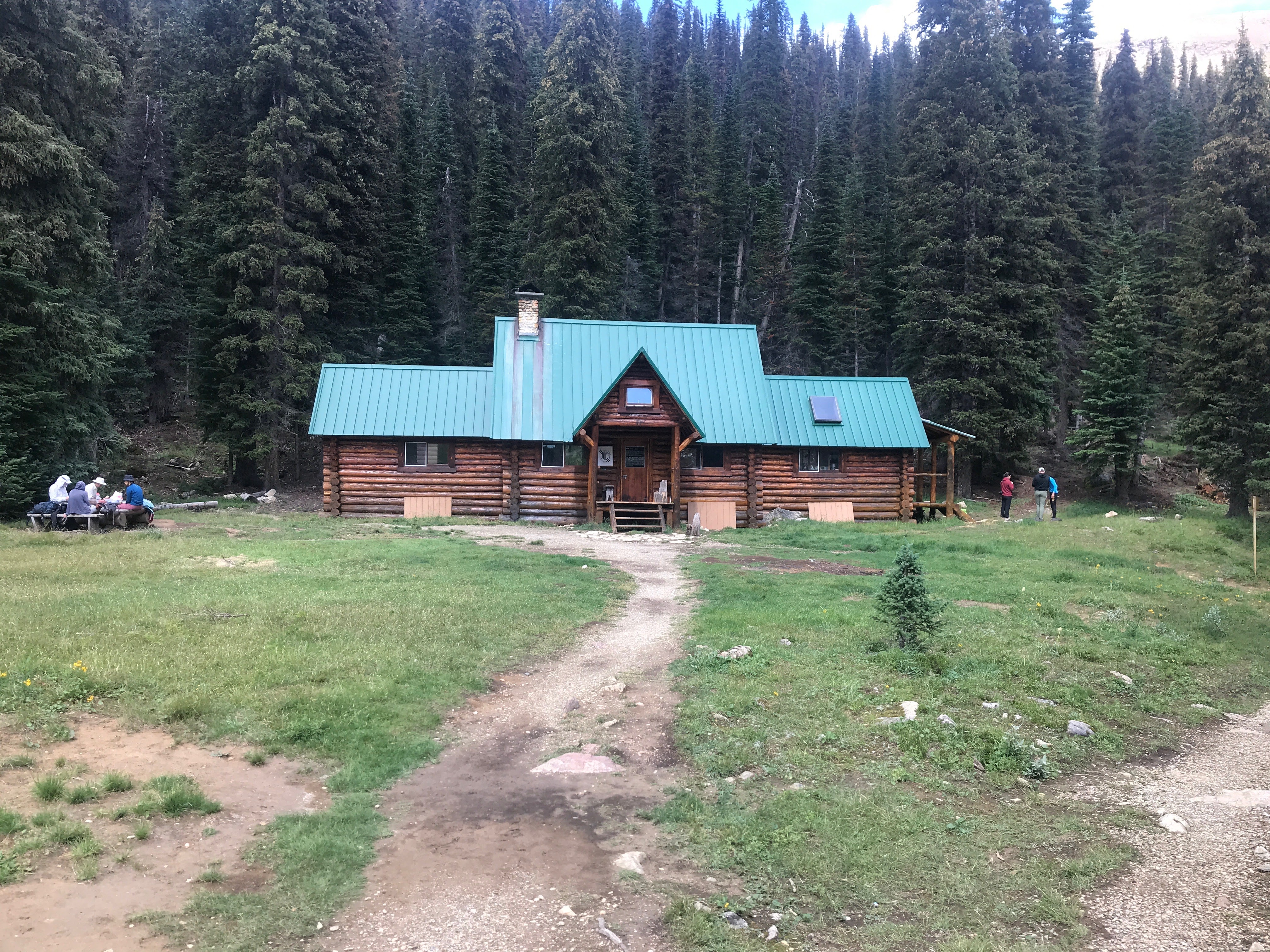
We had an interesting hiker's dilemma when we descended to Stanley Mitchell Hut.  We met up with a scrambler who had a hiker in his party, who was injured below Isolated Peak.  He asked if we had an emergency locator beacon (which we both did) that we could activate that would send a search-and-rescue helicopter and team.  After some discussion we determined that the injured party was not in life-threatening danger (a rock had fallen on her leg), and that she still had some mobility.  There were four in his party - him, his buddy, and two girlfriends,  He was from Czech republic.  We were reluctant to activate the beacons because we weren't sure what the protocol was for non-life-threatening situations.  He told us that in his country there was no question that a beacon would be activated, and that a helicopter rescue would be executed.  After some more discussion we agreed to high-tail it back to the trailhead (10 km = ~2 hours), get in touch with the parks officials, and let them handle it.  At that point there was still seven hours of daylight left.  I don't think he was too happy with that decision.  We debated the scenario all the way back, and after talking to Banff Dispatch it wasn't clear to us what the right decision was.  I will be asking around in the future to see if I can get clearer direction.  At the end of the day, I am comfortable with the decision we made, but had it gone differently I likely would have felt that we should have gone the other way...

Stanley Mitchell Hut

Laughing Falls And The Yoho River

The Silty Yoho River - It Looked Like A River Of Milk!

It ended up being a tremendous day of hiking.  I would most definitely like to go back and do it again with Amanda, or try one of the surrounding peaks (Whaleback).  The mixture of forest trail, glacier till, glacial streams to cross, lakes, huts, and water falls makes this a very fun and enjoyable hike - I give it five hiking boots out of five!

Sunday, August 21, 2022

August 20, 2022 - Mustang Hills, Elbow, Kananaskis

One of the reasons I feel so lucky to live where we do is when little segments of free time open up and allow us to get out into the mountains on short notice.  Where we used to live these opportunities would require an extra couple of hours for travel time to and from the trailhead, and as a result did not occur as frequently as they do now.  With everybody busy working and nothing going on at the house the other day I was able to head out to Mustang Hills for a quick hike.

The Mustang Hills (also known as the Rainy Creek Hills) are a group of three hills between Highway 66 and the Elbow River, just east of Rainy Summit.  I had not done them before but have observed them many times from Powderface Ridge, Forgetmenot Ridge, and Nihahi Ridge.  I did them in counter-clockwise fashion, although after coming home and checking Gillian Daffern's book, realized that she recommends doing them clockwise.

I had mixed feelings about the hike, and was reminded of a couple important things along the way.  I think it is safe to say that based on the dozens of cob web strands I had to wipe off of my face that this trail is not heavily used.  The first couple of kilometers is spent paralleling the river.  I spotted a couple of fly-fishers from the riverbank looking excited about the hole they were currently working, but didn't stick around long enough to see them reel anything in.


Fishermen Testing Their Luck

Elbow River With Forgetmenot Ridge In The Background

Saggy Butt Burl Picture I Took For Our Hiking Pal Lexi

Shortly after that I started climbing to the first hill top.  During this first section of the hike I was convinced it was not likely one I would be doing again in the near future.  At that point it had been mostly cob webs and no notable views.  My mind was changed once I got up out of the trees to the first summit.  The views were outstanding, and the meadows made the next part of the hike very enjoyable.  I am very glad I did not let the first bit deter me from sticking it out.  In a better mood, I let Mother Nature do her work lifting my spirits, clearing my mind, and refreshing my soul.

Wildflower

First Hilltop Cairn

Obligatory Selfie Shot

The second thing I was reminded of while doing this hike was that I was grateful for the Canada app I use for route-finding.  It saved me some considerable frustration by helping get me back on track when the route was lost several times.  This hike would be a little tricky without proper maps or a route-finding app.  For anybody who is interested search "Canada topo" in the App Store.  The icon looks like this:

Canada App Icon


Screen Shot Of Mustang Hills Trails

I have found the app to be excellent for several reasons: it is free, no service is required  to use it(make sure you have the correct maps downloaded before heading out), and it is very accurate.  It has a handy  distance tool on it, and current location arrow so you can always see where you are in relation to the actual trail.  Of course research, maps, compass, and preparation are always the best option, but this tool makes things very easy to stay on track!

On the final descent of the day I was remarking how quiet a hike it had been.  I decided to use the opportunity to practice getting my bear spray out as quickly and efficiently as possible.  You can never be too prepared!

Descent View - Mount Glasgow, Mount Cornwall, Banded Peak, Outlaw

This was not the most spectacular or interesting hike I have ever done, but it definitely did the trick.  It is a pleasant, easy, quiet hike, suitable for a time-limited outing.

Monday, August 8, 2022

July 24, 2022 - Pocaterra Ridge South Summit, Highwood, Kananaskis

Sam and I got out for a beautiful early-morning hike.  We had wanted to do the entire ridge, but the North end is currently closed for construction and maintenance.  See Sam's excellent post here for all of the details and another sweet video!

Pocaterra South Summit Selfie

Sam On Pocaterra Summit, Looking Towards Grizzly Col

Sam's Mini-Scramble On The Way Up

Looking Back Along Highwood-Grizzly Ridge North End

Sam Beside Pocaterra Creek

Beautiful Meadow - Pocaterra Creek, Ptarmigan Cirque In The Distance

Friday, July 22, 2022

July 19-20, 2022 - Forgetmenot Ridge Wild Camp, The Elbow, Kananaskis

When Sam had some plans fall through at the last minute we pulled the trigger on an outing we have been discussing this summer.  We would hike up to Forgetmenot Ridge in the evening, watch the sunset, camp on the ridge overnight, and wake up in time for the sunrise.

We left the house around 6:00 p.m., and were on the trail at Little Elbow by 6:20.  Sam set a furious pace once we crossed the Little Elbow River and started up the steep trail to the ridge.  Luckily he took mercy on me and let me have a few 30-second breaks on the way up! 😬

Sammy Crossing The Little Elbow

When we got to the ridge it was actually quite windy.  We searched around, and found a little oasis of trees to pitch our tent behind and it was so well protected you would not have known there was even a breeze.  With camp set up we headed to a good vantage point to watch the sun set, and cook our dinner: one pack of mushroom parmesan risotto, one pack of chicken blanquette with egg noodles, and one of Mandy's homemade jammy dodgers for dessert.  Yummm!

Enjoying The Sunset - Dinner On The Stove

Last Views Of The Sun

Looking East From Camp Just Before Bed

Once the sun had settled behind Nihahai Ridge we did not need any encouragement to get into our warm sleeping bags for the night.  We stashed our bear vault with food and toiletries, and our pots in a nearby stand of trees for the night, and headed back to camp.  Since our campsite was so protected and the skies were predicted to be clear, we decided to leave the fly off the tent and enjoy the starry skies all night.  With the big dipper in our direct line of sight as well as hundreds of other stars and a very bright half-moon, we were treated to a spectacular show!  We were all nestled in by ~10:30, with our alarm set for 4:30, in anticipation of the 5:50 sunrise.  I wouldn't say it was the best sleep ever (Sam had a nightmare which didn't help him), but it was a great experience nevertheless.

I am glad we set the alarm so early as when I took a peak from our tent as soon as the alarm went off, the sky was already a deep orange on the horizon.  We got out of our very warm and cozy sleeping bags, grabbed the stove and bear vault, and headed up to a high viewing point for tea and coffee.  Fortunately the wind had died down overnight and we were able to enjoy the sunrise in some comfort.  The hot drinks definitely helped out!!

4:30 a.m. Tent Wake-Up

Sunrise Shot

Old Man Admiring The Sunrise

Sunrise Selfie

Early-Morning Campsite

After enjoying the views for 1.5 hours we headed back to break up camp and start our descent back to the car.  It was another beautiful morning and we made quick work of the hike out.  After crossing the Little Elbow we took a slight shortcut and crossed the Elbow River adjacent to the parking lot which cut a kilometer or two off of the hike out.  The Elbow ended up being a little close to the edge of my comfort zone, but we were careful, and the excitement was a good way to cap off the adventure. 😳

Check out Sam's amazing video here for a very cool summary of our trip!!