Thursday, September 16, 2021

September 16, 2021 - Grizzly Peak, Kananaskis Valley, Kananaskis

We completed another Kananaskis first for us today - Grizzly Peak.  Amanda has wanted to do this one all summer, and I think we picked the perfect day to attempt it.  At 9:30 at the trail head it was ~4 C, sunny with partially cloudy skies.  Over the course of the hike we probably ranged from 0 C at the top to 15 C back near the bottom.

Our good hiking buddy Professor Lexie, and her son Mikey were with us today, which made for a fun and enjoyable hike.  I think it is safe to say for all of us that this was the hardest 6 km we have ever walked - three kilometers straight up (885 m elevation), followed by three kilometers straight down.  It took us 4.5 hours to cover 6 km, with a quick stop at the summit and a short lunch break on the way back down, which is a good indicator of how tough this hike was.

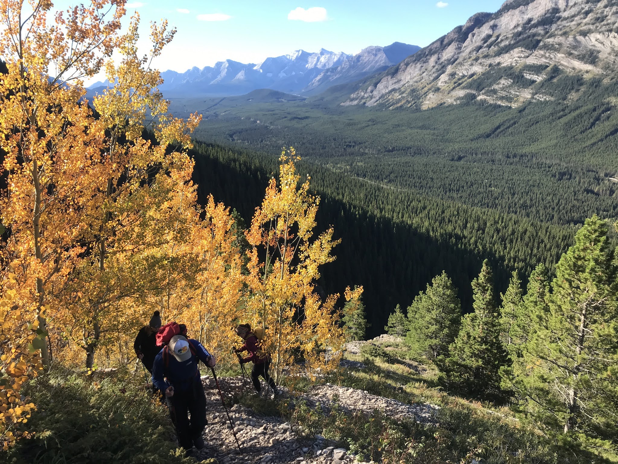
Beautiful Leaves

It Didn't Take Long To Start Gaining Elevation After Leaving The Road

Lexie and Mikey - Looking South Down The Kananaskis Valley

The highlight of the walk (aside from the incredible scenery) was watching a grizzly mama no more than 100 m below, lead her cubs away from us down into the valley.  This is only our second encounter with a grizzly while hiking, but it was very special as we were able to relax and watch the three of them walking through the meadow without any fear or concern.  It was also pretty cool to be able to say that we saw some grizzlies on our way up to Grizzly Peak!!

Mama Grizzly With Her Two Cubs

Two More Mama Grizzlies!!

There were a number of good vantage points on the hike also that allowed us to get good views of Mount Pakenham, Mount Even-Thomas, Upper and Lower Kananaskis Lakes, Mount Hood, and the near-vertical layers of the south end of Opal Ridge.  In addition, we managed to spot the two baby larches mentioned in "Scrambles In The Canadian Rockies" on the final approach to the summit in their full autumn colours.

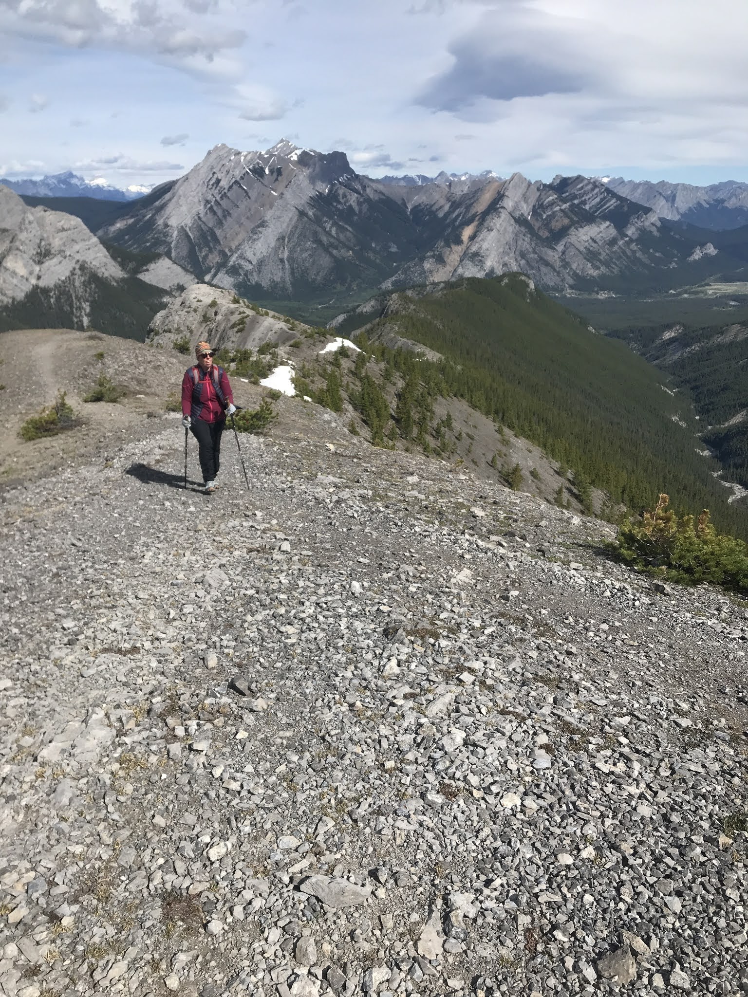
Scree Section Approaching The Saddle - Lower And Upper Kananaskis Lakes In Background

Still Smiling At The Saddle Before The Final Approach

Baby Larch

Final Steps Before The Summit - With A Terrifying Drop-Off To The Left

Lexie Loves Mountains, Hates Heights!!

The hike down was as slow as the hike up but the satisfaction of having made it to the summit kept our minds from acknowledging the fatigue that was starting to creep in to our muscles and joints.  We made our customary stop at the Esso at the corner of Hwy. 40 and the Trans-Canada for a cold pop and piece of beef jerky.  It was a good ending to an exciting and challenging hike!

Lunch Break

Small Scramble Section On Way Down

Home Stretch - Grizzly Peak In Back

Wednesday, August 18, 2021

August 18, 2021 - Bryant Lake, Powderface Trail, Kananaskis

With a week of rain coming up in the forecast, we had to make sure we took advantage of today - sunny and clear with a nice cool high of 16-18 C.  Last night Amanda asked me to pick a hike for today with our good friend Lexie.  I broke out the maps and Gillean Daffern's Kananaskis Country Trail Guide books.  This one jumped out at me, and it was one we hadn't done before.  It has a moderate elevation gain but lots of payout, with a gorgeous mountain lake at the top, surrounded by beautiful ridges and summits.  The hike follows Canyon Creek initially, and then Upper Canyon Creek the rest of the way up to Bryant Lake.  The creek bed is very walkable the whole way but there are many intermittent trails on the banks which are much easier than the creek bed.  The trails continuously start and end, but it is easy to find another bit to follow.  The creek bed has to be crossed many times, but it seems to add to the fun.  This was made much easier by the fact there is currently no flowing water.

Canyon Creek River Bed

BHB - Best Hiking Buds!

We were hopeful that this would be a good hike, but it far exceeded our expectations.  There were views the whole way up, and every type of terrain and feature - river bed, meadow, rocks, boulders, scree, waterfalls, forest trails, and a beautiful alpine lake.  In addition to all of this, the back and forth across the creek bed and the intermittent river bank trails made this a very fun walk.  Lunch at Bryant Lake was surreal.  "The blue-green tarn cradled in a basin under Mount Bryant" as Gillean Daffern describes it, is a very special place indeed, and we had it all to ourselves.  We enjoyed a very peaceful moment (and had quite a few laughs) as we devoured our PB&Js, and Lexie's delicious Cadbury's Fruit & Nut chocolate bar.

Boulders

Meadows

Scree

Alpine Lake - Bryant Lake

Walking with our friend Lexie is always entertaining, and educational (she happens to be a biology instructor at MRU so we always learn a lot about rocks, plants, and animals as we go).  Today we learned about Lion's Mane Mushrooms, which turns out to be a very good description.  It was a great hike (might be in my top 5 Kananaskis hikes of all time), a great time, and a great workout.  I would highly recommend this hike to my friends, and hope to bring my father on it in September when he comes to visit (rest up, Jojo!!).

Three Amigos

Post-PBJ Shenanigans

Home Stretch

Saturday, July 24, 2021

July 21, 2021 - Floe Lake, Kootenay National Park

An old colleague of mine was going to recce a trail in Kootenay National Park for a family hike he was planning, and asked me if I would like to join him for the out-and-back hike to Floe Lake.  I'm always up for a great hike, and it would be nice to catch up with him so I was all in!  Ben and I had previously backpacked the Tumbling Creek arm, and Amanda and I had done the Helmet Creek arm so I was excited to do the Floe Lake arm.

We met at the Petro-Canada on the Trans-Canada at 6:30, and got to the trail head at 8:30.  It didn't take long for me to need to layer down (about five minutes!).  There was lots of catching up to do so the hike seemed to go very quickly.  I had forgotten how much wildfires have affected the area over the years, but I still found the burnt trees made for quite a beautiful landscape.

Burnt Tree Beauty

There are lots of fantastic views along the way, and Floe Lake itself is like the cherry on top.  It was a very picturesque spot to eat my PB&Js (despite quite a few flies).

Floe Lake Pano

PB&J Time!

After a little exploring we started the return journey.  It was quite warm on the way down and I was feeling it with an empty water bottle.  I managed to refill it from Floe Creek just shortly before we crossed Vermillion River.  It was delicious!!

View Back Down Floe Creek Valley

Vermillion River Almost Back To The Trailhead

We were back at the car around 3:00 after 23 km and 1,000m of ascent feeling satisfied and a little tired.  I think the consensus was that my friend should be OK to bring his two young kids for an overnight adventure, having to be careful at one little sketchy spot that is probably more scary for us adults than the kids!  I was happy to have helped out, and hope I get the call for some other recce missions in the future!

July 9, 2021 - Mount Lipsett, The Highwood, Kananaskis

Ben and I headed out Friday morning after I finished a few chores in town.  Amanda wasn't able to join because she was getting ready for her farmer's market the next day.  We had all done Lipsett together in the past, but it is one of our faves, so we agreed it would be nice to do again.

We hit the trail around noon, and I was glad the approach is well-treed as the shade provided some welcome relief from the heat wave we had been experiencing.  Not surprisingly, despite not having hiked for a while, Ben set a tough pace for us.  We reeled in several groups on the way to the summit, and managed to get there with virtually no breaks.  Fortunately we got some good conversation going to keep my mind off the fact that my lungs were wanting to explode.  I think we solved a few of the world's problems.  If only we were kings...

Ben Letting Me Catch Up

The summit was as beautiful as it always is, and we were able to enjoy our France-trip-inspired beurre-et-jambon sandwiches by ourselves.  It is such a peaceful spot with great views up to Highwood Pass, and over to Mist Mountain.

Summit Selfie Looking Towards Highwood Pass

After about 20 minutes we resumed our conversation as we headed back down to the car.  I really enjoyed the hike, the time together, and the customary pop and chips at the Longview Esso on the way home.

Tuesday, July 13, 2021

July 3, 2021 - Mount Burke, Lower Cataract/Livingstone, Kananaskis

Sam and I decided late Friday to get up early on Saturday and head out to Mount Burke.  The weather was supposed to be hot, but if we could get there early enough we should be alright.  We got up at 5:00, hit the road by 5:30 after a quick breakfast, and were at the trail head by 7:00.  The weather was beautiful.  It was still cool but it did not take us long to warm up and have to layer down.

On The Trail Early

Beautiful Morning Sunshine

Sam Chewing Up The Trail

Sam set a furious pace and it became clear he wouldn't be letting me take many breaks.  We were above the tree line in under an hour.  After a quick sip of water we pushed on towards the top.  He was a man on a mission!

Above The Tree Line

Another 45 minutes later we were at the summit where we enjoyed a little rest and a bit of a snack.  

Sam Heading Over The Hump Before THe Final Push

The End Is In Sight

Abandoned Fire Lookout With Plateau Mountain In The Distance

We explored the abandoned fire lookout, and enjoying the 360-degree views for a little while.  I am always amazed at Plateau Mountain and its huge summit meadows.  Sam and I put that one on the list for a possible future hike.  We started our descent shortly after that and made it back to the car before the heat got to be too much.  It was a great hike, a great workout, and I really enjoyed the company and the conversation!!

Starting Our Descent

Wildlife Update - We saw a marmot at the summit.   I had seen one near the summit a couple of years ago, and I wondered if this one was the same one or related.

Monday, July 12, 2021

June 11, 2021 - Wasootch Ridge, Kananaskis Valley, Kananaskis

Amanda had wanted to do Wasootch Ridge for a while now so we headed out early Friday morning with good weather being forecasted.  We were on the trail by about 7:45.  Within a few minutes we passed a woman coming down from the ridge.  It looked like she either hiked up in the dark to watch the sunrise, or stayed on top overnight.  Either way, this planted a seed in our minds...

The first stretch is a steep grind, with half of the day's elevation coming in the first 1.5 km.  The payout for this is 360-degree views from that point on.  Because of this I would say that the hike is a rewarding one, regardless of how long you have or how far you want to go.

Early In The Hike - Looking North Towards Barrier Lake

We ended up going to about one kilometer from Wasootch summit.  Each time we stopped to assess whether or not the wind was too strong to continue we kept deciding to go up to the next step.  After about four or five times doing this we finally turned around.  I was OK with it as the last section to the summit seemed like it would be quite steep and exposed which is not my favourite thing with the wind strength we were already experiencing.

Looking SE Up Porcupine Creek Valley Towards Bryant Ridge

Further Up The Ridge

Getting Windier...

View Towards Wasootch Summit

Looking Back On Most Of The Ridge - Almost Time For Us To Turn Around

Another Great Hike In The Books!

We made it back to the car around noon, and back to the house around 13:00, ready for a soak in the hot tub!

Sunday, July 11, 2021

May 2-14, 2021 - Scotland Virtual Crossing

It has been a couple of years since Amanda and I have been to Scotland to hike and backpack.  Since COVID would prevent us from going this year, and because the TGOC was officially a go this June, we decided to do a virtual crossing by doing day hikes at home here in Alberta.  We ended up hiking 250 km across 13 days.  While we had the luxury of hot showers, hot meals, and our own bed to sleep in, it was still quite a challenge.  We had to be quite flexible due to it being the shoulder season, and also due to keeping the house and the three boys going on with normal life.  We had fun doing it, but look forward to be able to do another real Scottish crossing in the upcoming years.

Day #1 Scotland Virtual Crossing: Virtual route - Morar to Sgurr Breac in the North Morar Mountains. Actual route - 18.5 km on the West Bragg Creek Trails (Mountain Road - Mountain View West - Moose Loop - Braggin Rights). We finished just in time for the snow/sleet to start. We are off to a good start - legs and feet feel good so far! We’ll see how tomorrow goes...

Day 1, Step 1

Home Stretch


Day #2 Scotland Virtual Crossing: Virtual route - Sgurr Breac, North Morar to Arcabhi, Loch Arkaig via Glen Dessarry. Actual route - A bit of a dog’s breakfast due to still-icy trails: 10 km around Upper Kananaskis Lake, 6 km along Old Baldy Trail east side of Hwy. 40, and 7.5 km along Evan-Thomas Bike Path.
Wildlife update - one moose, one bighorn sheep, and one scottish sheep (see photos )

Hello, Moose!!

Upper Kananaskis Lake

Highland Sheep Sighting!!

Day #3 Scotland Virtual Crossing: Virtual route - Arcabhi, Loch Arkaig to Inverroy just past Spean Bridge, camping at Forester’s Croft Campground
Actual route - Another mish-mash of trails due to Sam’s driving lesson and JM’s Covid vaccine: 10 km around the block, 10 km along the Bow River in Cochrane (Mandy), 8.5 km along the Bow River in Banff (JM), the rest back on the local road for a total of 26 km each.
Wildlife update - two geese, and one Highland sheep (again )
Health update - JM had tight calves, no blisters, Mandy feeling good, no blisters.


Windy Last Few Kilometers On The Local Road


Day #4 Scotland Virtual Crossing: Virtual route - Inverroy to Loch Spey, Corrieyairack Forest
Actual route - Sheep River Valley - 20 km on Pine Ridge Loop and Death Valley Loop, 3 km on High Noon Hills Trail.
Our toughest day so far - mentally more so than physically. The mostly muddy trails, and the terrible bread we used to make our PB&Js did not help.
Wildlife update - one goose, a few white-tailed deer.

Grumpy

Death Valley

Quick Stop On Windy Point Trail

Day #5 Scotland Virtual Crossing: Virtual route - Loch Spey, Corrieyairack Forest to Garva Bridge. (Passed by Melgarve Bothy on the way, where we had one of the most entertaining nights ever during TGOC 2017.)
Actual route 10 km on West Bragg Trails, Ranger Summit and Strange Brew loops.
We had lots going on at the house today so we took a “rest day” and only headed out for a quick hike around 3:30 this aft.
Wildlife update - two squirrels fighting and tonnes of Scottish sheep sightings!!

Trail Running Scottish Sheep

Tree-Climbing Scottish Sheep

Scottish Sheep Taking A Break

Day #6 Scotland Virtual Crossing: Virtual route - Garva Bridge to unnamed Loch NE of Phones and 4 km South of Newtonmore
Actual route - 10 km along Bow River in Cochrane (Sam at driving school again), and 10 km to the post office in Bragg Creek and back.
Wildlife update - no Scottish sheep sightings today.
Health update - blister situation still good, bodies still holding up.

Bow River From Cochrane

Day #7 - Scotland Virtual Crossing: Virtual route - Unnamed Loch NE of Phones to high plateau East of Ruigh Aiteachain Bothy in Glen Feshie.
Actual route - 25 km along Bow River starting in Gleneagles, Cochrane to Bearspaw and back, in Glenbow Ranch Provincial Park.
We may as well have been in Scotland for real today - sideways rain, mist, snow, sleet, and no sun!! Our rain kilts came in handy! An easy Sunday walk for the Scots! The scenery was still exceptional and the walk went well. Amanda channeled her inner Scot and set a furious pace for both of us, for the walk back to the trailhead after we got to the halfway point. I am feeling it now!
Wildlife update - Lots of birds (swans, geese, ducks, hawks, songbirds), a Scottish sheep sighting, and a Highland Coo!!!!!

A Beautiful Scottish Sunday
Bow River Valley

A Highland Coo!!!!

Bow River

Day #9 - Scotland Virtual Crossing: Virtual route - High plateau East of Ruigh Aiteachain Bothy in Glen Feshie to Glen Lui a few kilometres past Derry Lodge.
Actual route - 12 km in Nose Hill Park in Calgary, followed by 8 km along the Bow River in downtown Calgary.
Our urban hike was very nice after Saturday’s weather fiasco. It was cool and clear out this morning, which made for some great walking! We noticed a lot of trees with buds opening, which is a sure sign of spring.
Wildlife update - We saw a cute Canada Goose family on the side of the Bow River, another sure sign of spring.

Nose Hill Park

The Buds Are Opening!

Urban Hiking - Downtown Calgary

Day #10 - Scotland Virtual Crossing: Virtual route - Glen Lui past Mar Lodge where we stopped for tea and biscuits, through Braemar to Ballochbuie Forest.
Actual route - 10 km along the Bow River in Cochrane (another of Sam’s driving lessons), followed by 10.5 km around the block at home.
We passed two very special places on our virtual route today: Geldie Burn where we met three of the the most kind and generous hikers ever - not to mention innovative!! We have since met up with these three on two other occasions during Scotland trips, as well as once in Okotoks. Joyce Robertson, Moira Munro, and Martin we miss you guys tonnes, and think of you often!! We also passed Braemar today where we were treated to a most enjoyable evening at the Flying Stag at the Fife Arms Hotel by Paul, Howard, and Nigel - three very witty Englishmen with so many funny stories! Being on this virtual crossing we have been reminded how special the friendships we have made on the Scotland crossings have been to us, and how anxious we are to get back there for some more hiking...
We are about three days away from making our 250 km goal on this virtual crossing. Hopefully we continue to be blessed with decent weather, and no blisters. Thanks for reading our posts, and for all of the moral support, everybody!!

Bow River - Cochrane

Day #11 - Scotland Virtual Crossing: Virtual route - Ballochbuie Forest to campground in Ballater.
Actual route - 10 km to the village, over the Elbow River towards West Bragg Creek and back, followed by 10 km around Big Hill Creek and along the Bow River in Cochrane (Sam’s last driving lesson).
We both felt tired as we passed the 200 km mark today. On the upside we finished by 12:30 so we have lots of rest opportunity this afternoon.
Wildlife update - We watched an Osprey hunt for and catch lunch, and managed to capture it on video (see attached). Very spectacular!! We also saw a black bear scavenging from a dead carcass on the side of the road on the way back. We pulled over and watched for a few minutes.


Elbow River On The Way To The Hamlet


Foot Break By The Bow River


Day #12 - Scotland Virtual Crossing: Virtual route - Ballater to a few kilometre past Aboyne on south side of River Dee.
Actual route - 21.5 km along the Bow River in Cochrane (had an appointment to replace the windshield on one of our cars).
Despite the great system of paths in Cochrane, I think we have had our fill of them. Fitting this walk in while maintaining the house and keeping up with all of the appointments has been one of the biggest challenges. Despite all that we have one day to go!!! We are both excited to finish this long walk off tomorrow.
Wildlife update - We managed to spy the Highland cow and sheep today after a few days hiatus!!


Highland Coo And Sheep Enjoying The Bow River View

Old Man On A Rock

Day #13 - Scotland Virtual Crossing (WE MADE IT!!!): 250 km total.
Virtual route - Past Aboyne on south side of River Dee to a few kilometres past Banchory. From here we hopped into the River Dee and bobbed the rest of the way to Aberdeen where we had a wonderful dinner and visit with Noira, Joyce, Anne and Martin - haggis, tatties, neeps, as well as a wee dram for dessert. It was wonderful!!!
Actual route - 20 km along the Elbow River in Kananaskis from the winter gate (which opens tomorrow) to Forgetmenot Pond and back. Ben and Sam saw us off at the gate as they were going to bike the same route we would walk - with the gate still closed there are no cars on the road. We did stop for a little celebration at the halfway point which included a little shot of whiskey, and some “Scottish tablet”. It was a very nice pick-me-up for the home stretch.
While we enjoyed this challenge, it was nothing compared to the real thing. Hopefully next year we will be in Scotland attempting an actual crossing, meeting up with old friends, and making some new memories.
Wildlife update - We managed to spy the Highland Coo and sheep today for one last time!!


On The Home Stretch


Scottish-Style Celebration

Cheers!  We Made It!

Bye Bye, Coo!

Bye Bye, Sheep!